Jacksonville, FL    Kingsland, GA Progress series    Site mapping    Property records
Request a scope
New home under construction in a Camden County community
Builders and general contractors Land and lot developers Property owners

A permanent record of how the site got built.

Recurring aerial documentation and site mapping for development work across Northeast Florida and Southeast Georgia. Flown from the same positions every visit, delivered in formats your team already opens, and organized so month five can sit beside month one and read as one sequence.
Part 107
FAA certified pilot
Same positions
Angles repeat every visit
48 hours
Files back after each flight
Insured
Certificate on request
What gets flown

Four kinds of work on a development site.

Most projects start with one of these and add a second once the value of having the record is obvious.

Construction progress documentation
Recurring, on a schedule

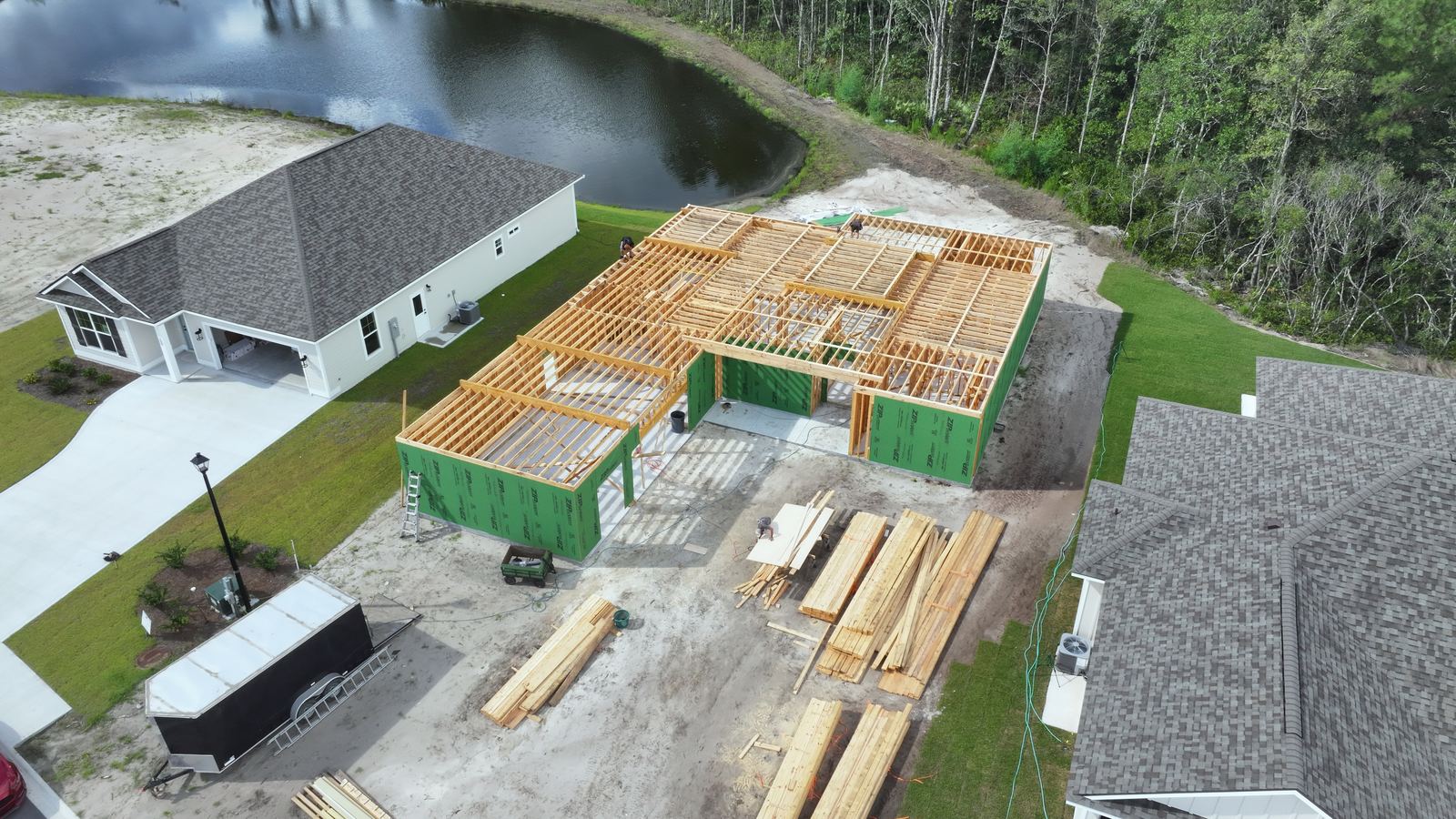
The site changes every week and almost none of it gets recorded. Repeat flights over an active build, shot from fixed positions and altitudes, so the set reads as one sequence instead of a folder of unrelated photos. Useful for draw requests, owner updates, subcontractor coordination and the argument you have eighteen months from now about what was under that slab.

  • Fixed position photo set
  • Site overview video
  • Month to month comparisons
  • Ground level detail passes
  • Shared gallery per project
  • Dated, numbered file names
From $450 a visit$1,200 a month, two visits
House at the framing stage beside completed homesProgress, framing stage
Site mapping and orthomosaics
Top down, measurable

Hundreds of overlapping images stitched into one top down map of the whole site, at a resolution you can zoom into. Distances and areas are measured off the image, and the file exports into the mapping and design software your engineers already use. Good for planning, staging, quantity checks and showing a parcel as it actually sits today rather than as the last aerial photo showed it.

  • Stitched orthomosaic
  • Measured distances and areas
  • Elevation and terrain view
  • GeoTIFF for GIS and CAD
  • PDF map sheet
  • Ground control on request
From $750 a siteFull day $1,600
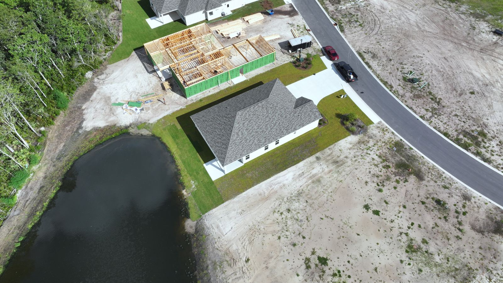
Top down aerial of a house, driveway and lotTop down, single lot
Lot and community marketing
Built to sell land

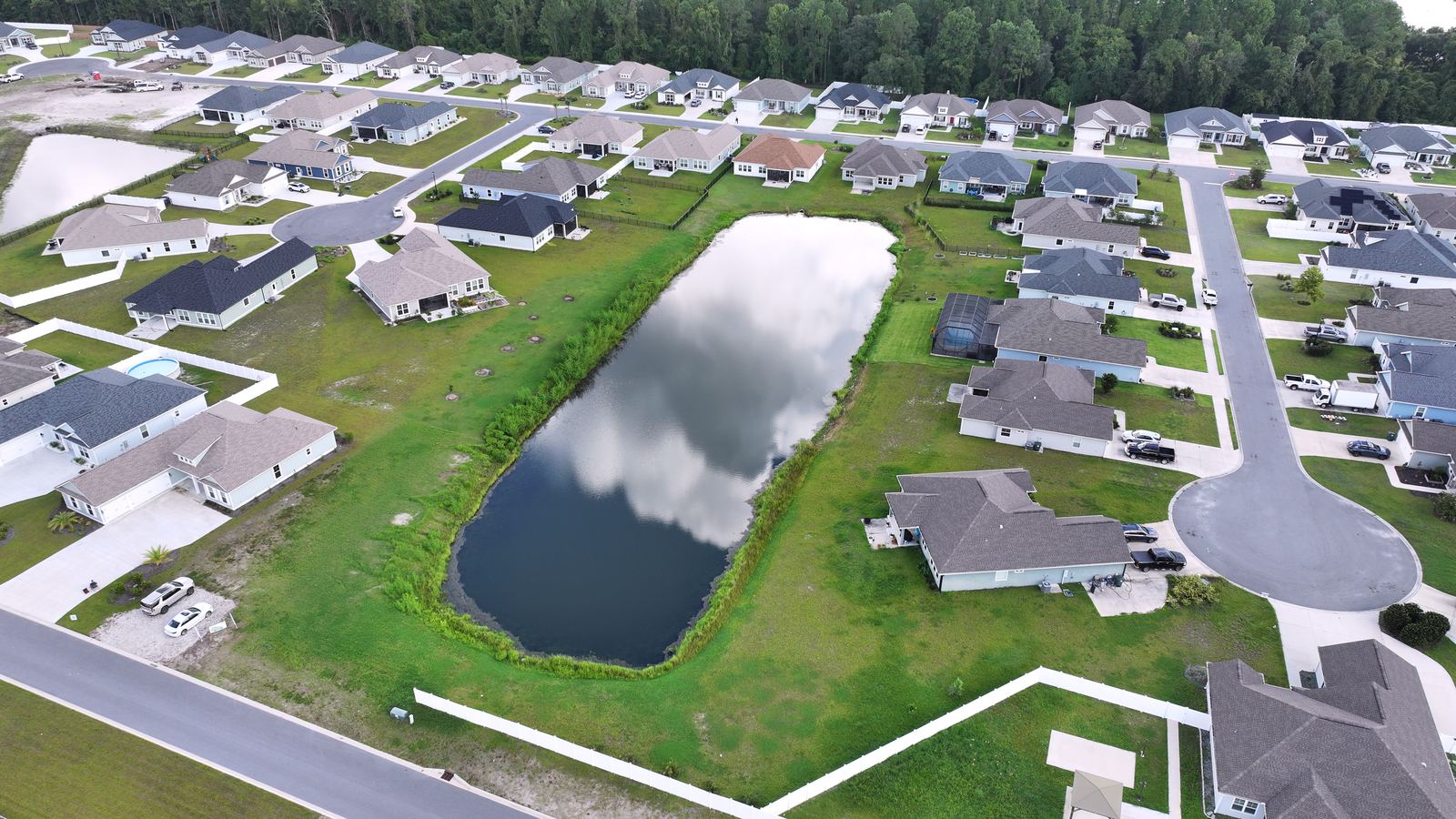
Aerials made for a sales conversation. Lot lines drawn on the image, amenities labeled, and the drive to the water, the school or the highway shown in a single frame. The same flight covers the sales office wall, the listing page and the flyer, so a buyer looking at a cleared lot can see what the address is actually near.

  • Lot line overlays
  • Labeled amenities and access
  • Community overview video
  • Phase and parcel callouts
  • Crops for print and web
  • Reshoots as phases open
$650 a communityPhase reshoots quoted
Aerial of a new construction community and pondCommunity aerial
Property and roof documentation
Dated condition record

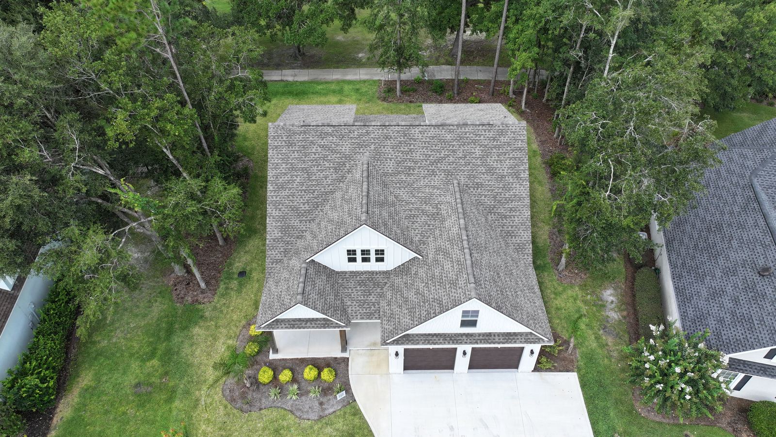
A dated visual record of a structure, captured before hurricane season, at the close of a build, or near the end of a warranty period. Every roof plane and elevation covered, close passes on anything already showing wear. When a claim or a warranty argument comes up later, you have imagery from before it happened instead of a memory of how the roof used to look.

  • Every roof plane covered
  • Four elevation sets
  • Close detail passes
  • Dated and labeled export
  • Organized by structure
  • Repeat visits on request
From $275 a structurePortfolios quoted
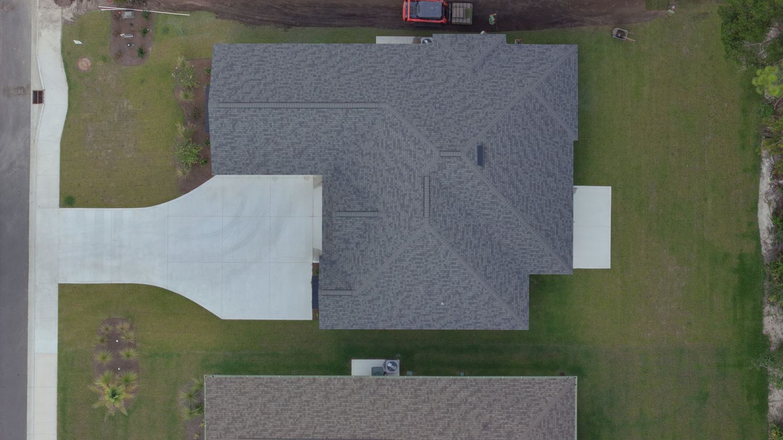
Top down view of a completed roof and drivewayRoof, top down
What arrives

Files your team can open without calling me.

Everything lands in a private gallery, named and dated, downloadable in full resolution.

Photography

Full resolution JPEG, aerial and ground level, named by site, date and position so the sequence stays in order on its own.

Video

A 4K overview edit of each visit, plus a vertical cut when the footage is going to a sales page or a social account.

Maps

Orthomosaic as a GeoTIFF for GIS and CAD, a flat JPEG for presentations, and a PDF map sheet with the measurements marked.

Access

One gallery link per project, kept online for a year, organized by visit date. Share it with the owner, the lender or the crew.

DeliverableFormatOpens in
Progress photo setJPEG, full resolutionAnything
Site overview videoMP4, 4KAnything
OrthomosaicGeoTIFF, JPEGQGIS, ArcGIS, AutoCAD, Civil 3D, most site software
Map sheetPDFAnything
MeasurementsMarked PDF, CSV on requestAnything, Excel
Point cloudLAS on requestRecap, CloudCompare, Civil 3D
Where the line is

Documentation, not land surveying.

Worth saying plainly up front, because the difference matters on a permit.

What this is not.

I fly, capture and document. I am not a licensed surveyor and these deliverables are not a substitute for one.

  • Not a boundary or plat survey. Measurements are for planning, progress tracking and coordination. Anything that has to hold up on a plat, a permit or a property line dispute needs a licensed Florida or Georgia surveyor, and I will say so rather than let you find out later.
  • Accuracy depends on the method. A standard flight is accurate enough to compare visits, plan staging and estimate quantities. If a job needs tighter absolute accuracy, that means ground control points on site, and I will quote the added time before the flight rather than overstate what a normal flight gives you.
  • No engineering opinions. I document what the site looks like on the day I fly it. Whether it was built correctly, and what to do about it, is your engineer's call.
  • Airspace can say no. Parts of this region sit under controlled airspace, including the approaches around Kings Bay, Jacksonville International and Cecil. Authorization is usually straightforward, occasionally slow, and rarely refused outright. I check before you are scheduled, not after.
How a project runs

Three steps, then it repeats.

The first visit takes a conversation. After that it runs on the calendar without you managing it.

1Scope and airspace

We go over the parcel map or walk the site, agree on what the documentation is for, and set the flight positions. I check the airspace, file for authorization if the location needs it, and confirm who to call for site access on flight days. If the project has a phase schedule, the visit calendar gets built around it.

You get
  • Flight position plan
  • Visit schedule
  • Authorization handled
  • Certificate of insurance
2The flight

On site inside the agreed window, usually thirty to ninety minutes depending on the size of the parcel. Same positions, same altitudes, same order every visit, which is the whole reason the comparison works later. Mapping flights run a grid pattern instead and take longer. Weather moves a visit, never cancels it, and you hear from me the morning of rather than after I have driven out.

On the day
  • No crew stoppage needed
  • Ground and aerial capture
  • Safety brief if required
  • Rescheduled free for weather
3Delivery

Edited, named, dated and in the gallery within forty eight hours of the flight. Mapping takes longer to process, usually three to five days, and you get a delivery date when the flight is booked. Every visit after the first arrives with the comparison set alongside it, so the change since last month is visible without anyone digging through folders.

You get
  • Full resolution downloads
  • Comparison set
  • Map exports if mapping
  • Gallery kept for a year
Pricing

Start here, then it gets quoted.

Site size, phase count and how often you want flights all move the number. These are the starting points.

Single visit
One flight, one site
$450
  • Fixed position photo set
  • Site overview video
  • Ground level detail passes
  • Delivery in 48 hours
  • Gallery kept for a year
Book a visit
Most development work
Monthly documentation
Two visits a month
$1,200 a month
  • Two flights, same positions
  • Comparison set every visit
  • Quarterly recap edit
  • Priority scheduling
  • Owner ready update gallery
Start documentation
Site mapping
Orthomosaic and measurements
From $750
  • Stitched orthomosaic
  • Measured distances and areas
  • GeoTIFF and PDF map sheet
  • Elevation and terrain view
  • Ground control quoted separately
Request a map
Project workRateWhat it covers
Progress flight, single visit$450One site, one flight window, photo set and overview video
Monthly documentation$1,200 a monthTwo visits, comparison set, quarterly recap
Orthomosaic, under 20 acres$750Map sheet, GeoTIFF, measurements
Orthomosaic, 20 to 100 acres$1,400Same deliverables, larger flight plan
Full day mapping$1,600Multiple parcels or phases in one day
Lot and community marketing$650Overlays, labeled aerials, community video
Roof and exterior documentationFrom $275Per structure, dated condition record
Larger and longer

Sites above 100 acres, projects with several active phases, and portfolios of structures are quoted after a scope call. Six month documentation commitments hold the monthly rate.

Add ons

Ground control points $250 a site. Extra vertical cut $95. Interior progress walkthrough $200. Same week mapping turnaround $300.

Travel and scheduling

Beyond 30 miles, $0.70 a mile. Weather reschedules are free. Cancellations inside 24 hours for any other reason are billed at half.

Launch pricing. These rates are held through December 31, 2026.

Questions

Before you scope a project.

Can you fly near Kings Bay or the Jacksonville airports?−
Usually yes, with authorization. Controlled airspace covers a good part of this region, including the approaches around Naval Submarine Base Kings Bay, Jacksonville International and Cecil. Most requests come back approved through the FAA authorization system, some take a few days, and a small number of locations do not get cleared at all. I check the site before you are scheduled and tell you which case you are in.
Do you need the site shut down or the crew stopped?+
No. I fly around active work rather than over people, and the flight plan is built to avoid holding anyone up. If your site requires a safety orientation, a badge or a specific check in, tell me during scoping and I will do it on the first visit so later visits are routine.
Will the mapping files open in what our engineers use?+
The orthomosaic exports as a GeoTIFF with location data, which drops into QGIS, ArcGIS, AutoCAD, Civil 3D and most site management software. If your team wants a point cloud or a specific export format, say so during scoping and I will confirm it before the flight rather than promising a format and sorting it out afterward.
Are the measurements accurate enough to build from?+
They are accurate enough to plan, compare and estimate from, and not a replacement for survey data. A standard flight relies on the aircraft's own positioning, which is good for relative measurement across a site and looser in absolute terms. Placing ground control points tightens that considerably, and I quote it as an add on when a project needs it. Anything legal or permitted needs a licensed surveyor.
What happens when it rains on a flight day?+
The visit moves. You hear from me the morning of, not after the window has passed, and there is no charge for a weather reschedule. In a Florida summer a monthly visit sometimes lands in the last week of the month rather than the first.
Can you document a project already halfway built?+
Yes, and it is worth starting even late. The first flight sets the positions and becomes the baseline, and everything after it compares cleanly. For anything already finished, a single visit still gives you a dated record of the completed site.
Do you carry insurance and can we get a certificate?+
Yes. Liability coverage is in place on every flight and a certificate naming your company goes out before the first visit if your contract requires it. Send the requirements during scoping and I will confirm the coverage meets them.

Tell me about the site.

Parcel size, where it is, what stage it is at and what the documentation is for. I will come back with a flight plan, a schedule and a number.

Jacksonville and Northeast Florida    Kingsland and Camden County